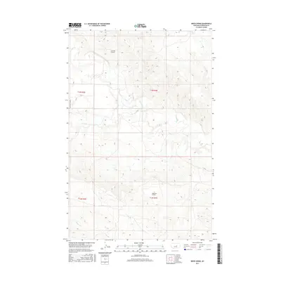
2017 Map of Breed Spring
USGS Topo · Published 2017About this map
Gorman Coulee and Anderson Coulee define the drainage patterns of this Petroleum County landscape, where the seasonal flow of high-plains water dictates the geography. The terrain is marked by the eponymous Breed Spring in the northeast corner and the winding course of Flatwillow Cr through the central sections. Human presence is sparse, etched into the map by the straight lines of the Public Land Survey System and the lone thoroughfare of Petrolia Bench Rd. This 2017 survey reflects the enduring character of central Montana, where major watercourses like Box Elder Cr and N Maginnis Cr remain the primary landmarks for navigation and land management across the vast townships of t14n r28e and t14n r29e.
Find a feature on this map
13 named features on this map. Tap any name to fly to it.
Don’t see what you’re looking for? This feature index may not catch every label — zoom into the map to look around manually.
Map Details
Editions of this 2017 Breed Spring Map
This is the sole edition of this map. No revisions or reprints were ever made.
Other maps of this area

1954 · Jordan
USGS Topo · 1:250,000

1954 · Forsyth
USGS Topo · 1:250,000

1954 · Roundup
USGS Topo · 1:250,000

1954 · Lewistown
USGS Topo · 1:250,000

1956 · Jordan
USGS Topo · 1:250,000

1957 · Forsyth
USGS Topo · 1:250,000

1958 · Jordan
USGS Topo · 1:250,000

1958 · Roundup
USGS Topo · 1:250,000

1958 · Forsyth
USGS Topo · 1:250,000

1959 · Lewistown
USGS Topo · 1:250,000