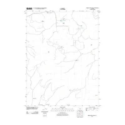
2010 Map of Breeze Mountain
USGS Topo · Published 2010About this map
Breeze Mountain and the high country of Routt County dominate this landscape, where the primary human footprint is found in water management and extraction. The northern edge of the sheet follows a bend of the Yampa River, but the surrounding terrain is defined by a network of drainage features like Holderness Gulch and Jeffway Gulch. Local ranching and agricultural history are evidenced by a series of named dams and pools, including Kowach Reservoir, Basin Reservoir, and Dresher Reservoir, which capture runoff from the peaks. Industrial activity is marked by the Jim Dunn Mine in the southern portion of the quadrangle, connected to the broader region by a spiderweb of county routes and the Deep Cut Ditch.
Find a feature on this map
31 named features on this map. Tap any name to fly to it.
Don’t see what you’re looking for? This feature index may not catch every label — zoom into the map to look around manually.
Map Details
Editions of this 2010 Breeze Mountain Map
This is the sole edition of this map. No revisions or reprints were ever made.
Other maps of this area

1910 · Danforth Hills
USGS Topo · 1:125,000

1915 · Monument Butte
USGS Topo · 1:62,500

1916 · Craig
USGS Topo · 1:125,000

1916 · Daton Peak
USGS Topo · 1:62,500

1920 · Daton Peak
USGS Topo · 1:62,500

1923 · Elkhead Creek
USGS Topo · 1:62,500

1924 · Elkhead Creek
USGS Topo · 1:62,500

1954 · Craig
USGS Topo · 1:250,000

1957 · Craig
USGS Topo · 1:250,000

1958 · Craig
USGS Topo · 1:250,000