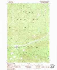
1988 Map of Breitenbush Hot Springs
USGS Topo · Published 1988About this map
Breitenbush Hot Springs serves as a focal point for this high-elevation landscape where the Mt Hood National Forest meets the Willamette National Forest. This 1980s survey captures the intersection of forestry management and recreation, centered on the confluence of the North Fork and South Fork Breitenbush River. The map documents established infrastructure including the Breitenbush Guard Station and Cleator Bend Campground, set against the backdrop of Rhododendron Ridge and Hawk Mountain. To the southeast, the terrain transitions into the Mt Jefferson Wilderness, characterized by a network of drainage systems like Roaring Creek and Devils Creek. The presence of numerous meadows, such as Cachebox Meadow and Twin Meadows, suggests the varied alpine ecology of this protected mountain corridor.
Find a feature on this map
51 named features on this map. Tap any name to fly to it.
Don’t see what you’re looking for? This feature index may not catch every label — zoom into the map to look around manually.
Map Details
Editions of this 1988 Breitenbush Hot Springs Map
2 editions found
Other maps of this area

1927 · Mt. Jefferson
USGS Topo · 1:125,000

1929 · Mill City
USGS Topo · 1:125,000

1930 · Mt. Jefferson
USGS Topo · 1:125,000

1953 · Salem
USGS Topo · 1:250,000

1954 · Salem
USGS Topo · 1:250,000

1955 · Bend
USGS Topo · 1:250,000

1956 · Battle Ax
USGS Topo · 1:62,500

1956 · Detroit
USGS Topo · 1:62,500

1957 · Bend
USGS Topo · 1:250,000

1958 · Bend
USGS Topo · 1:250,000