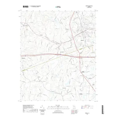
2020 Map of Bremen
USGS Topo · Published 2020About this map
Bremen and the surrounding west Georgia landscape are defined by a complex network of settlements and infrastructure crossing the Haralson Co Carroll Co line. The rail corridor, marked by the Norfolk Southern, anchors the growth of Waco and Tallapoosa to the west. Local history is deeply embedded in the rural landscape, visible through numerous ancestral sites such as the Union Camp Ground Cem near Jake and the Bethlehem Cem further south in Mandeville.
Find a feature on this map
182 named features on this map. Tap any name to fly to it.
Don’t see what you’re looking for? This feature index may not catch every label — zoom into the map to look around manually.
Map Details
Editions of this 2020 Bremen Map
This is the sole edition of this map. No revisions or reprints were ever made.
Other maps of this area

1889 · Tallapoosa
USGS Topo · 1:125,000

1892 · Tallapoosa
USGS Topo · 1:125,000

1897 · Tallapoosa
USGS Topo · 1:125,000

1953 · Atlanta
USGS Topo · 1:250,000

1957 · Atlanta
USGS Topo · 1:250,000

1958 · Atlanta
USGS Topo · 1:250,000

1958 · Carrollton
USGS Topo · 1:62,500

1958 · Buchanan
USGS Topo · 1:62,500

1965 · Tallapoosa South
USGS Topo · 1:24,000

1966 · Tallapoosa North
USGS Topo · 1:24,000