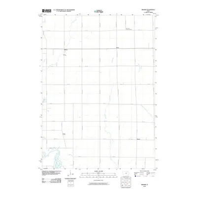
2010 Map of Bremer
USGS Topo · Published 2010About this map
Horton, Roxie, and Bremer anchor this agricultural landscape in Bremer County, where a well-defined grid of section roads like Easton Ave and 150th St organizes the fertile Iowa prairie. The southwest corner is dominated by the meandering course of the Cedar River, providing a stark contrast to the straight-line drainage patterns of the surrounding uplands. Local history is deeply embedded in the rural landscape, marked by family and community landmarks such as Horton Cemetery and the Saint Johns Lutheran Cemetery to the north. Smaller watercourses, including Baskins Run and Quarter Section Run, cut through the terrain, illustrating the natural drainage system that supported the early farmsteads. The presence of Andrews Cemetery further highlights the distributed nature of early settlement in this part of the state.
Find a feature on this map
31 named features on this map. Tap any name to fly to it.
Don’t see what you’re looking for? This feature index may not catch every label — zoom into the map to look around manually.
Map Details
Editions of this 2010 Bremer Map
This is the sole edition of this map. No revisions or reprints were ever made.
Other maps of this area

1954 · Waterloo
USGS Topo · 1:250,000

1955 · Waterloo
USGS Topo · 1:250,000

1963 · Waverly
USGS Topo · 1:24,000

1963 · Denver
USGS Topo · 1:24,000

1971 · Shell Rock
USGS Topo · 1:24,000

1971 · Bremer
USGS Topo · 1:24,000

1971 · Tripoli NW
USGS Topo · 1:24,000

1971 · Plainfield
USGS Topo · 1:24,000

1971 · Frederika
USGS Topo · 1:24,000

1971 · Tripoli
USGS Topo · 1:24,000