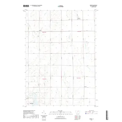
2018 Map of Bremer
USGS Topo · Published 2018About this map
The Cedar River corridor defines the southwestern portion of this Bremer County landscape, where the northern edge of Waverly transitions into a grid of agricultural townships. This 2018 survey reveals a rural structure sustained by a network of numbered section roads and county highways, including Co Hwy V14 and Co Hwy V21. Settlement patterns are anchored by the small community of Horton in the north and the namesake locale of Bremer further south, both situated amidst a terrain drained by several creeks and runs.
Find a feature on this map
38 named features on this map. Tap any name to fly to it.
Don’t see what you’re looking for? This feature index may not catch every label — zoom into the map to look around manually.
Map Details
Editions of this 2018 Bremer Map
This is the sole edition of this map. No revisions or reprints were ever made.
Other maps of this area

1954 · Waterloo
USGS Topo · 1:250,000

1955 · Waterloo
USGS Topo · 1:250,000

1963 · Waverly
USGS Topo · 1:24,000

1963 · Denver
USGS Topo · 1:24,000

1971 · Shell Rock
USGS Topo · 1:24,000

1971 · Bremer
USGS Topo · 1:24,000

1971 · Tripoli NW
USGS Topo · 1:24,000

1971 · Plainfield
USGS Topo · 1:24,000

1971 · Frederika
USGS Topo · 1:24,000

1971 · Tripoli
USGS Topo · 1:24,000