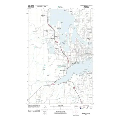
2011 Map of Bremerton West
USGS Topo · Published 2011About this map
Sinclair Inlet and the Port Washington Narrows define the maritime character of this region, which serves as a critical naval and industrial hub for the Olympic Peninsula. The city of Bremerton dominates the eastern shoreline, supported by neighborhoods like Navy Yard City and Sheridan Village. The map details the complex infrastructure of the early 21st century, including the Bremerton Ferry Landing and the Warren Avenue Bridge. Beyond the urban centers, the landscape transitions into the wooded hills of Eldorado Hills and Sunnyslope, where the presence of the Kitsap Quarry and Sherman Heights Quarry points to the area's geological and extractive utility.
Find a feature on this map
93 named features on this map. Tap any name to fly to it.
Don’t see what you’re looking for? This feature index may not catch every label — zoom into the map to look around manually.
Map Details
Editions of this 2011 Bremerton West Map
This is the sole edition of this map. No revisions or reprints were ever made.
Other maps of this area

1936 · Point Misery
USGS Topo · 1:62,500

1937 · Port Orchard
USGS Topo · 1:62,500

1938 · Allyn
USGS Topo · 1:62,500

1940 · Point Misery
USGS Topo · 1:62,500

1942 · Gig Harbor
USGS Topo · 1:62,500

1943 · Gig Harbor
USGS Topo · 1:62,500

1953 · Seabeck
USGS Topo · 1:24,000

1953 · Poulsbo
USGS Topo · 1:24,000

1953 · Burley
USGS Topo · 1:24,000

1953 · Bremerton West
USGS Topo · 1:24,000
Featured Places
- Bremerton, WA
- Port Orchard, WA
- Tracyton, WA
- East Port Orchard, Port Orchard
- Erlands Point-Kitsap Lake, WA