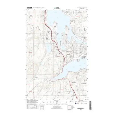
2017 Map of Bremerton West
USGS Topo · Published 2017About this map
Sinclair Inlet and Dyes Inlet define the maritime landscape of this region on the Great Peninsula. The urban centers of Bremerton, Port Orchard, and Navy Yard City are mapped in detail, showing the densely developed waterfronts and the critical infrastructure connecting them, such as the Warren Avenue Bridge. Beyond the industrial and naval hubs, the map reveals a transition to residential and recreational areas near Kitsap Lake and the smaller Jarstad Lake.
Find a feature on this map
227 named features on this map. Tap any name to fly to it.
Don’t see what you’re looking for? This feature index may not catch every label — zoom into the map to look around manually.
Map Details
Editions of this 2017 Bremerton West Map
This is the sole edition of this map. No revisions or reprints were ever made.
Other maps of this area

1936 · Point Misery
USGS Topo · 1:62,500

1937 · Port Orchard
USGS Topo · 1:62,500

1938 · Allyn
USGS Topo · 1:62,500

1940 · Point Misery
USGS Topo · 1:62,500

1942 · Gig Harbor
USGS Topo · 1:62,500

1943 · Gig Harbor
USGS Topo · 1:62,500

1953 · Seabeck
USGS Topo · 1:24,000

1953 · Poulsbo
USGS Topo · 1:24,000

1953 · Burley
USGS Topo · 1:24,000

1953 · Bremerton West
USGS Topo · 1:24,000
Featured Places
- Bremerton, WA
- Port Orchard, WA
- Tracyton, WA
- East Port Orchard, Port Orchard
- Erlands Point-Kitsap Lake, WA