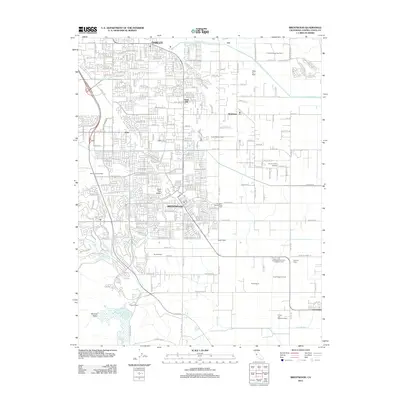
2012 Map of Brentwood
USGS Topo · Published 2012About this map
Agricultural legacy and suburban expansion define this 2012 survey of eastern Contra Costa County. Brentwood and Oakley serve as the primary hubs, surrounded by a transition from residential developments to established ranching and farming operations. The landscape is interconnected by a complex network of waterways, including the Contra Costa Canal and the Main Canal, which support a series of named agricultural holdings such as Smith Family Farms, Knoll Organic Farms, and Terada Farms. To the north and west, the terrain rises toward Sand Hill and the Briones Valley, while the eastern portion remains low-lying near Rock Slough. Regional industry is visible through the Brentwood Gas Field and the Dutch Slough Gas Field, while local transit and recreation are represented by the Funny Farm Airport and the waters of Marsh Creek Reservoir.
Find a feature on this map
63 named features on this map. Tap any name to fly to it.
Don’t see what you’re looking for? This feature index may not catch every label — zoom into the map to look around manually.
Map Details
Editions of this 2012 Brentwood Map
This is the sole edition of this map. No revisions or reprints were ever made.
Other maps of this area

1896 · Mt. Diablo
USGS Topo · 1:62,500

1898 · Mt. Diablo
USGS Topo · 1:62,500

1907 · Antioch
USGS Topo · 1:62,500

1908 · Antioch
USGS Topo · 1:62,500

1910 · Bouldin
USGS Topo · 1:31,680

1910 · Jersey
USGS Topo · 1:31,680

1911 · Byron Hot Springs
USGS Topo · 1:31,680

1913 · Woodward Island
USGS Topo · 1:31,680

1914 · Brentwood
USGS Topo · 1:31,680

1914 · Bethany
USGS Topo · 1:31,680