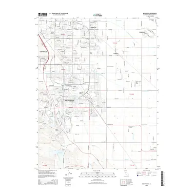
2015 Map of Brentwood
USGS Topo · Published 2015About this map
Brentwood and Oakley anchor this modern landscape where residential suburbanization meets established agricultural infrastructure. The map details a complex water management system essential to the San Joaquin Valley, featuring the Mokelumne Aqueduct and the winding Contra Costa Canal. To the south and west, the terrain transitions into the foothills of Briones Valley and Lone Tree Valley, where the Marsh Creek Reservoir manages drainage from Marsh Creek. While the northern reaches show the expansion of Antioch, the eastern portions near Knightsen retain a more rural character defined by drainage canals like the Forty-Five Canal. Notable for local history and genealogy is the Byron Brentwood Knightson Cemetery situated along the boundary between these growing communities. Smaller historic nodes like Arbor and Sand Hill are also clearly marked, providing reference points for the region's mid-century development and land use shifts.
Find a feature on this map
41 named features on this map. Tap any name to fly to it.
Don’t see what you’re looking for? This feature index may not catch every label — zoom into the map to look around manually.
Map Details
Editions of this 2015 Brentwood Map
This is the sole edition of this map. No revisions or reprints were ever made.
Other maps of this area

1896 · Mt. Diablo
USGS Topo · 1:62,500

1898 · Mt. Diablo
USGS Topo · 1:62,500

1907 · Antioch
USGS Topo · 1:62,500

1908 · Antioch
USGS Topo · 1:62,500

1910 · Bouldin
USGS Topo · 1:31,680

1910 · Jersey
USGS Topo · 1:31,680

1911 · Byron Hot Springs
USGS Topo · 1:31,680

1913 · Woodward Island
USGS Topo · 1:31,680

1914 · Brentwood
USGS Topo · 1:31,680

1914 · Bethany
USGS Topo · 1:31,680