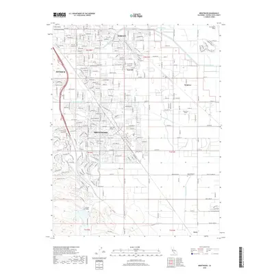
2018 Map of Brentwood
USGS Topo · Published 2018About this map
The Mokelumne Aqueduct and Contra Costa Canal cut through this Contra Costa County landscape, illustrating the critical water infrastructure supporting the eastern suburban expansion of Antioch and Brentwood. By the late 2010s, residential developments had filled much of the Lone Tree Valley, yet the map still preserves the distinct boundaries of older rural communities like Knightsen and Byron. The transition from the Sacramento Valley to the San Joaquin Valley is marked by a network of drainage and irrigation features, including Dutch Slough and the Forty-Five Canal. Genealogists will find the Byron Brentwood Knightsen Cem located central to these historic settlements. While urban growth is evident along Lone Tree Way, the southern reaches near Briones Valley and Kellogg Cr maintain a more open character, punctuated by landmarks such as the curiously named Funny Farm Airport.
Find a feature on this map
36 named features on this map. Tap any name to fly to it.
Don’t see what you’re looking for? This feature index may not catch every label — zoom into the map to look around manually.
Map Details
Editions of this 2018 Brentwood Map
This is the sole edition of this map. No revisions or reprints were ever made.
Other maps of this area

1896 · Mt. Diablo
USGS Topo · 1:62,500

1898 · Mt. Diablo
USGS Topo · 1:62,500

1907 · Antioch
USGS Topo · 1:62,500

1908 · Antioch
USGS Topo · 1:62,500

1910 · Bouldin
USGS Topo · 1:31,680

1910 · Jersey
USGS Topo · 1:31,680

1911 · Byron Hot Springs
USGS Topo · 1:31,680

1913 · Woodward Island
USGS Topo · 1:31,680

1914 · Brentwood
USGS Topo · 1:31,680

1914 · Bethany
USGS Topo · 1:31,680