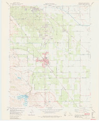
1978 Map of Brentwood
USGS Topo · Published 1978About this map
Brentwood and Oakley anchor this landscape during a period of agricultural and infrastructural development in eastern Contra Costa County. The map details a complex water management system essential to the region, featuring the Contra Costa Canal, the Main Canal, and the Mokelumne Aqueduct cutting across the terrain. These systems, alongside the Marsh Creek Reservoir, supported the orchards and fields of Los Meganos and Lone Tree Valley.
Find a feature on this map
59 named features on this map. Tap any name to fly to it.
Don’t see what you’re looking for? This feature index may not catch every label — zoom into the map to look around manually.
Map Details
Editions of this 1978 Brentwood Map
3 editions found
Other maps of this area

1896 · Mt. Diablo
USGS Topo · 1:62,500

1898 · Mt. Diablo
USGS Topo · 1:62,500

1907 · Antioch
USGS Topo · 1:62,500

1908 · Antioch
USGS Topo · 1:62,500

1910 · Bouldin
USGS Topo · 1:31,680

1910 · Jersey
USGS Topo · 1:31,680

1911 · Byron Hot Springs
USGS Topo · 1:31,680

1913 · Woodward Island
USGS Topo · 1:31,680

1914 · Brentwood
USGS Topo · 1:31,680

1914 · Bethany
USGS Topo · 1:31,680