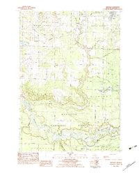
1982 Map of Brethren
USGS Topo · Published 1983About this map
The Manistee National Forest dominates this portion of Manistee County, where the winding course of the Manistee River creates a complex landscape of wetlands including Sergeant Bayou and Blacksmith Bayou. Settlement patterns in the early 1980s are concentrated around Brethren and Kaleva, with the Chesapeake and Ohio railroad corridor linking these communities through the townships of Maple Grove and Dickson.
Find a feature on this map
58 named features on this map. Tap any name to fly to it.
Don’t see what you’re looking for? This feature index may not catch every label — zoom into the map to look around manually.
Map Details
Editions of this 1982 Brethren Map
This is the sole edition of this map. No revisions or reprints were ever made.
Other maps of this area

1933 · Peacock NW
USGS Topo · 1:31,680

1954 · Traverse City
USGS Topo · 1:250,000

1954 · Manitowoc
USGS Topo · 1:250,000

1956 · Onekama
USGS Topo · 1:62,500

1957 · Freesoil
USGS Topo · 1:62,500

1957 · Copemish
USGS Topo · 1:62,500

1957 · Wellston
USGS Topo · 1:62,500

1958 · Traverse City
USGS Topo · 1:250,000

1958 · Manitowoc
USGS Topo · 1:250,000

1976 · Onekama SE
USGS Topo · 1:24,000