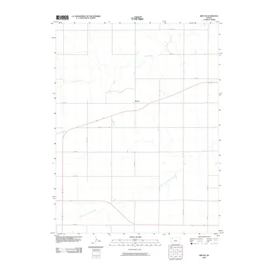
2009 Map of Breton
USGS Topo · Published 2009About this map
Breton stands as the primary focal point of this Thomas County landscape, situated within a vast agricultural grid defined by a network of county roads. The terrain is shaped by two significant drainage systems that carve through the High Plains: Prairie Dog Creek traverses the northern section of the quadrangle, while the North Fork Solomon River meanders across the southern portion. This 2009 survey by the U.S. Geological Survey illustrates the intersection of traditional section-line routes, such as Co Rd Z and Co Rd 34, with modern transportation corridors that cut diagonally across the survey lines. The placement of the settlement at Breton reflects the regional reliance on these vital water sources and the methodical organization of the Kansas prairie for large-scale ranching and farming operations.
Find a feature on this map
16 named features on this map. Tap any name to fly to it.
Don’t see what you’re looking for? This feature index may not catch every label — zoom into the map to look around manually.
Map Details
Editions of this 2009 Breton Map
This is the sole edition of this map. No revisions or reprints were ever made.
Other maps of this area

1951 · Selden
USGS Topo · 1:62,500

1951 · Achilles
USGS Topo · 1:62,500

1954 · Goodland
USGS Topo · 1:250,000

1956 · Goodland
USGS Topo · 1:250,000

1957 · Goodland
USGS Topo · 1:250,000

1978 · Long Draw South
USGS Topo · 1:24,000

1978 · Achilles SE
USGS Topo · 1:24,000

1978 · Selden SW
USGS Topo · 1:24,000

1979 · Menlo
USGS Topo · 1:24,000

1979 · Rexford
USGS Topo · 1:24,000