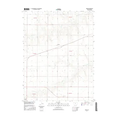
2015 Map of Breton
USGS Topo · Published 2015About this map
Breton and the surrounding plains of Thomas County are defined by the distinct drainage patterns of the High Plains. This landscape is bisected by the Prairie Dog Cr in the north and the N Fork Solomon River in the south, reflecting the essential relationship between water and the agricultural grid in Western Kansas. The topography reveals the subtle undulations of the upland divides between these two significant waterways. In the southern corner, the settlement of Halford marks a point of activity near the river valley. The map documents the extensive section-line road network, such as Co RD W and Co RD 32, which facilitates transport across this productive prairie environment.
Find a feature on this map
26 named features on this map. Tap any name to fly to it.
Don’t see what you’re looking for? This feature index may not catch every label — zoom into the map to look around manually.
Map Details
Editions of this 2015 Breton Map
This is the sole edition of this map. No revisions or reprints were ever made.
Other maps of this area

1951 · Selden
USGS Topo · 1:62,500

1951 · Achilles
USGS Topo · 1:62,500

1954 · Goodland
USGS Topo · 1:250,000

1956 · Goodland
USGS Topo · 1:250,000

1957 · Goodland
USGS Topo · 1:250,000

1978 · Long Draw South
USGS Topo · 1:24,000

1978 · Achilles SE
USGS Topo · 1:24,000

1978 · Selden SW
USGS Topo · 1:24,000

1979 · Menlo
USGS Topo · 1:24,000

1979 · Rexford
USGS Topo · 1:24,000