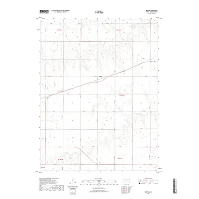
2018 Map of Breton
USGS Topo · Published 2018About this map
Breton and the southern settlement of Halford anchor this High Plains landscape, where the agricultural grid meets the natural drainage of the N Fork Solomon River. The map reveals a highly structured township system defined by a dense network of section-line roads, including Co RD X and Co RD 32, which cross the rolling terrain of the Solomon and Prairie Dog Cr watersheds. This 2018 survey illustrates the persistent geometry of Kansas ranching and farming, showing how modern transportation routes like US Highway 83 cut diagonally across the established range lines of t7s r32w and t7s r31w. The topographical detail captures the subtle breaks and draws that characterize the area's hydrology, providing a clear record of land use and water management in Thomas County.
Find a feature on this map
26 named features on this map. Tap any name to fly to it.
Don’t see what you’re looking for? This feature index may not catch every label — zoom into the map to look around manually.
Map Details
Editions of this 2018 Breton Map
This is the sole edition of this map. No revisions or reprints were ever made.
Other maps of this area

1951 · Selden
USGS Topo · 1:62,500

1951 · Achilles
USGS Topo · 1:62,500

1954 · Goodland
USGS Topo · 1:250,000

1956 · Goodland
USGS Topo · 1:250,000

1957 · Goodland
USGS Topo · 1:250,000

1978 · Long Draw South
USGS Topo · 1:24,000

1978 · Achilles SE
USGS Topo · 1:24,000

1978 · Selden SW
USGS Topo · 1:24,000

1979 · Menlo
USGS Topo · 1:24,000

1979 · Rexford
USGS Topo · 1:24,000