
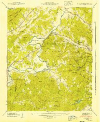
1935 Map of Brevard
USGS Topo · Published 1935About this map
French Broad River and its intricate network of tributaries define the landscape of the Blue Ridge foothills during the mid-1930s. The town of Brevard serves as a central hub, where Brevard College and the Southern Railway line signal the region's cultural and economic activity. Beyond the town limits, the terrain is dotted with small rural institutions like Dunn Creek School and Shady Grove Church, along with numerous family cemeteries such as Orr Cem and Glazener Cem.
Find a feature on this map
105 named features on this map. Tap any name to fly to it.
Don’t see what you’re looking for? This feature index may not catch every label — zoom into the map to look around manually.
Map Details
Editions of this 1935 Brevard Map
This is the sole edition of this map. No revisions or reprints were ever made.
Other maps of this area

1905 · Pisgah
USGS Topo · 1:125,000

1906 · Pisgah
USGS Topo · 1:125,000

1935 · Eastatoe Gap
USGS Topo · 1:24,000

1935 · Standingstone Mtn.
USGS Topo · 1:24,000

1935 · Horse Shoe
USGS Topo · 1:24,000

1935 · Rosman
USGS Topo · 1:24,000

1935 · Table Rock
USGS Topo · 1:24,000

1935 · Shining Rock
USGS Topo · 1:24,000

1935 · Pisgah Forest
USGS Topo · 1:24,000
1942 · Horse Shoe
USGS Topo · 1:24,000