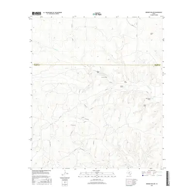
2016 Map of Brewer Hollow
USGS Topo · Published 2016About this map
The Menard Co and Kimble Co border defines this stretch of the Texas Hill Country, where a complex network of seasonal drainages and springs carved deep recesses into the limestone. Water management and access dominate the local landscape, evidenced by the clustered locations of Iona Springs, Walton Spring, and Cracked Spring. Near the central divide, the Bannowsky Cem stands as a focal point for genealogical interest, located just south of the county line near the headwaters of Big Saline Cr. The terrain is characterized by numerous named depressions, including Brewer Hollow and Cedar Hollow, which historically dictated the winding paths of rural routes like Co Rd 370 and Gentry Creek Rd. This pattern of springs and hollows suggests a long history of ranching and specialized land use in a region where reliable water sources were essential for settlement.
Find a feature on this map
36 named features on this map. Tap any name to fly to it.
Don’t see what you’re looking for? This feature index may not catch every label — zoom into the map to look around manually.
Map Details
Editions of this 2016 Brewer Hollow Map
This is the sole edition of this map. No revisions or reprints were ever made.
Other maps of this area

1954 · Llano
USGS Topo · 1:250,000

1955 · Llano
USGS Topo · 1:250,000

1956 · Llano
USGS Topo · 1:250,000

1968 · London
USGS Topo · 1:24,000

1968 · Yates
USGS Topo · 1:24,000

1970 · Julio Draw
USGS Topo · 1:24,000

1970 · Brewer Hollow
USGS Topo · 1:24,000

1970 · Elm Slough
USGS Topo · 1:24,000

1970 · East Elm Creek
USGS Topo · 1:24,000
1970 · Hext
USGS Topo · 1:24,000