
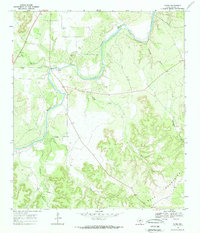
1968 Map of Yates
USGS Topo · Published 1971About this map
The Llano River winds through the heart of this landscape, carving a prominent path toward the Blue Mountains in the southeast. Located in the Texas Hill Country during the late 1960s, the small community of Yates serves as a central point for the surrounding ranchlands and river valleys. The topography is defined by significant drainage systems including Salty Creek, Cedar Creek, and Sycamore Creek, which feed into the primary river channel.
Find a feature on this map
11 named features on this map. Tap any name to fly to it.
Don’t see what you’re looking for? This feature index may not catch every label — zoom into the map to look around manually.
Map Details
Editions of this 1968 Yates Map
2 editions found
Other maps of this area

1887 · Mason
USGS Topo · 1:125,000

1894 · Mason
USGS Topo · 1:125,000

1894 · Kerrville
USGS Topo · 1:125,000

1954 · Llano
USGS Topo · 1:250,000

1955 · Llano
USGS Topo · 1:250,000

1956 · Llano
USGS Topo · 1:250,000

1968 · Monument Mountain
USGS Topo · 1:24,000

1968 · Sheep Run Creek
USGS Topo · 1:24,000

1968 · London
USGS Topo · 1:24,000

1970 · Brewer Hollow
USGS Topo · 1:24,000