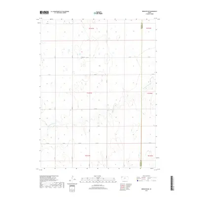
2018 Map of Brewster NW
USGS Topo · Published 2018About this map
The High Plains landscape of Sherman County is defined here by the gentle incision of the Middle Fork Sappa Cr, which snakes across the center and southeast portions of the township. This agricultural region is meticulously divided by a grid of section lines and county roads, reflecting the enduring legacy of the Public Land Survey System. A significant site for local family history is the Freeland Cem, situated north of Co RD 73. The map also captures the political boundary between Sherman Co and Thomas Co along its eastern edge. Aside from the scattered natural depressions and ephemeral water features, the terrain is largely shaped by rural thoroughfares like Peters Rd and various numbered routes that connect the isolated farmsteads of this western Kansas prairie.
Find a feature on this map
23 named features on this map. Tap any name to fly to it.
Don’t see what you’re looking for? This feature index may not catch every label — zoom into the map to look around manually.
Map Details
Editions of this 2018 Brewster NW Map
This is the sole edition of this map. No revisions or reprints were ever made.
Other maps of this area

1951 · Bird City South
USGS Topo · 1:62,500

1951 · Dewey Ranch
USGS Topo · 1:62,500

1954 · Goodland
USGS Topo · 1:250,000

1956 · Goodland
USGS Topo · 1:250,000

1957 · Goodland
USGS Topo · 1:250,000

1966 · Edson
USGS Topo · 1:24,000

1966 · Goodland NE
USGS Topo · 1:24,000

1966 · Brewster NW
USGS Topo · 1:24,000

1966 · Brewster
USGS Topo · 1:24,000

1966 · Brewster SE
USGS Topo · 1:24,000