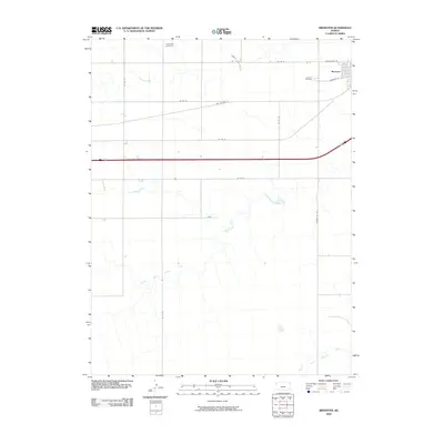
2009 Map of Brewster
USGS Topo · Published 2009About this map
Brewster anchors the northwestern corner of Thomas County in this 2009 survey, showing the grid-patterned settlement just north of the high-speed transit corridor. The map captures the subtle drainage patterns of the High Plains, where the headwaters of the South Fork Sappa Creek and the South Fork Solomon River begin their trek across the Kansas prairie. These seasonal watercourses dictate the placement of county roads that navigate the vast agricultural sections surrounding the town. Genealogy researchers will find precise locations for the Brewster Cemetery on the town's western edge and the more isolated Hollenbeck Cemetery to the northwest. The transition from historical transit to modern infrastructure is evident in the path of Old Us Hwy 24 as it parallels the more modern highway and local arteries like Railroad St, reflecting the town's enduring role as a regional hub for the surrounding farming community.
Find a feature on this map
16 named features on this map. Tap any name to fly to it.
Don’t see what you’re looking for? This feature index may not catch every label — zoom into the map to look around manually.
Map Details
Editions of this 2009 Brewster Map
This is the sole edition of this map. No revisions or reprints were ever made.
Other maps of this area

1954 · Goodland
USGS Topo · 1:250,000

1956 · Goodland
USGS Topo · 1:250,000

1957 · Goodland
USGS Topo · 1:250,000

1959 · Harris Draw
USGS Topo · 1:62,500

1966 · Edson
USGS Topo · 1:24,000

1966 · Goodland NE
USGS Topo · 1:24,000

1966 · Brewster NW
USGS Topo · 1:24,000

1966 · Brewster
USGS Topo · 1:24,000

1966 · Brewster SE
USGS Topo · 1:24,000

1967 · Brewster NE
USGS Topo · 1:24,000