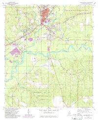
1960 Map of Brewton South
USGS Topo · Published 1986About this map
Murder Creek and Burnt Corn Creek converge just south of Brewton, defining the landscape of this southern Alabama county seat during the mid-20th century. The map highlights a transition from the urban grid of the town center—home to the Courthouse and Baptist Hill Ch—to the surrounding managed woodlands of the T R Miller Wildlife Management Area and the Escambia National Experimental Forest. Transportation is anchored by the Seaboard Coast Line railroad and the Brewton Municipal Airport. Local history is preserved in numerous family and community sites, such as the McLellan Cem and Fort Crawford Cem, which sit near the riverbanks. The winding Conecuh River dominates the southern half of the quadrangle, flanked by numerous oxbow lakes including Foshee Lake and Brantley Lake.
Find a feature on this map
62 named features on this map. Tap any name to fly to it.
Don’t see what you’re looking for? This feature index may not catch every label — zoom into the map to look around manually.
Map Details
Editions of this 1960 Brewton South Map
2 editions found
Other maps of this area

1943 · Jay
USGS Topo · 1:62,500

1948 · Munson
USGS Topo · 1:62,500

1950 · Munson
USGS Topo · 1:62,500

1953 · Andalusia
USGS Topo · 1:250,000

1957 · Andalusia
USGS Topo · 1:250,000

1957 · Pensacola
USGS Topo · 1:250,000

1959 · Pensacola
USGS Topo · 1:250,000

1959 · Brewton South
USGS Topo · 1:24,000

1960 · Pensacola
USGS Topo · 1:250,000

1960 · Brewton South
USGS Topo · 1:24,000