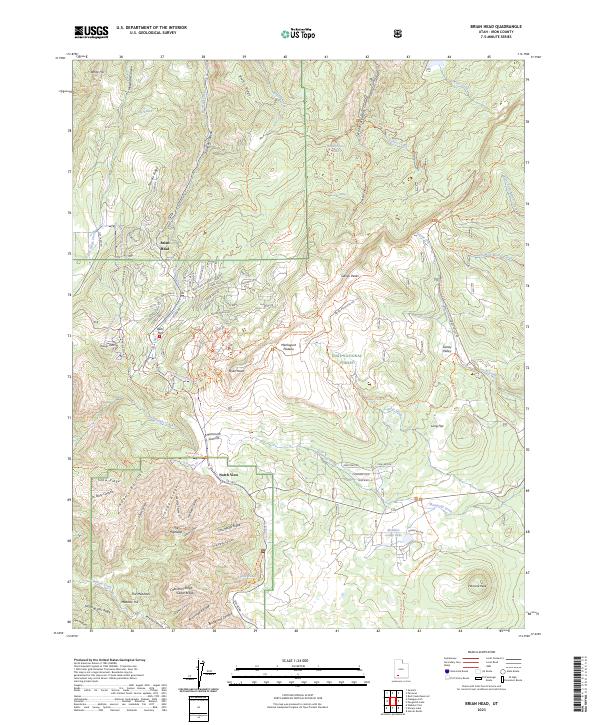
2023 Map of Brian Head
USGS Topo · Published 2023About this map
Brian Head sits at the heart of this high-elevation terrain, where the northern reaches of the Grand Staircase-Escalante National Monument meet the Dixie National Forest. The landscape is defined by the massive Markagunt Plateau, a complex geography of ridges and canyons like Chessmen Canyon and Adams Canyon. High-altitude water sources including Paradise Spring, Lodge Lake, and Alpine Pond dot the area, supporting a network of seasonal routes and ski trails. The map documents the intricate interface between wilderness protection in the Ashdown Gorge Wilderness and the growing recreational infrastructure around Bear Flat and North View. Geologic landmarks like Navajo Point and Hancock Peak dominate the southern horizon, while the drainage of Mammoth Creek carves through the eastern flats of Sidney Valley.
Find a feature on this map
118 named features on this map. Tap any name to fly to it.
Don’t see what you’re looking for? This feature index may not catch every label — zoom into the map to look around manually.
Map Details
Editions of this 2023 Brian Head Map
This is the sole edition of this map. No revisions or reprints were ever made.
Other maps of this area

1886 · Kanab
USGS Topo · 1:250,000

1953 · Cedar City
USGS Topo · 1:250,000

1958 · Cedar City
USGS Topo · 1:250,000

1958 · Cedar Breaks
USGS Topo · 1:62,500

1958 · Panguitch Lake
USGS Topo · 1:62,500

1962 · Cedar City
USGS Topo · 1:250,000
1971 · Summit
USGS Topo · 1:24,000

1971 · Parowan
USGS Topo · 1:24,000
1971 · Red Creek Reservoir
USGS Topo · 1:24,000

1980 · Panguitch
USGS Topo · 1:100,000