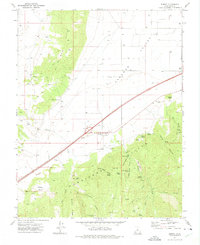
1971 Map of Summit
USGS Topo · Published 1975About this map
The town of Summit serves as the central anchor for this Iron County landscape, positioned at the mouth of the canyon where the Hurricane Cliffs meet the agricultural expanse of Parowan Valley. Published in the mid-1970s, the map reveals a complex water management and resource extraction system, noted by the presence of a Diversion Dam, a Gaging Station, and numerous wells across the valley floor. To the north, the Red Hills rise abruptly, featuring Red Peak and several prospects that hint at the region's mineral history.
Find a feature on this map
42 named features on this map. Tap any name to fly to it.
Don’t see what you’re looking for? This feature index may not catch every label — zoom into the map to look around manually.
Map Details
Editions of this 1971 Summit Map
This is the sole edition of this map. No revisions or reprints were ever made.
Other maps of this area

1885 · St. George
USGS Topo · 1:250,000

1886 · Kanab
USGS Topo · 1:250,000

1891 · St. George
USGS Topo · 1:250,000

1950 · Enoch
USGS Topo · 1:24,000

1950 · Cedar City
USGS Topo · 1:24,000

1950 · Enoch
USGS Topo · 1:62,500

1950 · Cedar City
USGS Topo · 1:62,500

1950 · Enoch NE
USGS Topo · 1:24,000

1952 · Enoch NE
USGS Topo · 1:24,000

1953 · Cedar City
USGS Topo · 1:250,000