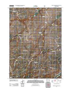
2011 Map of Bridge Creek Draw
USGS Topo · Published 2011About this map
Remery Ranch and Howard Ranch anchor the northern landscape of this high-desert region, where family ranching outposts are scattered among seasonal drainages and springs. The area is defined by the ephemeral flows of Buck Creek and Bridge Creek, which create natural corridors for travel and habitation in an otherwise arid environment. Evidence of land management and historical surveying is found at the McBroom Administrative Study Plot and near Buck Creek Crossing.
Find a feature on this map
35 named features on this map. Tap any name to fly to it.
Don’t see what you’re looking for? This feature index may not catch every label — zoom into the map to look around manually.
Map Details
Editions of this 2011 Bridge Creek Draw Map
This is the sole edition of this map. No revisions or reprints were ever made.
Other maps of this area

1889 · Klamath
USGS Topo · 1:250,000

1894 · Klamath
USGS Topo · 1:250,000

1955 · Crescent
USGS Topo · 1:250,000

1955 · Klamath Falls
USGS Topo · 1:250,000

1957 · Crescent
USGS Topo · 1:250,000

1958 · Crescent
USGS Topo · 1:250,000

1958 · Klamath Falls
USGS Topo · 1:250,000

1960 · Sycan Marsh
USGS Topo · 1:62,500

1960 · Yamsay Mountain
USGS Topo · 1:62,500

1968 · Silver Lake
USGS Topo · 1:24,000