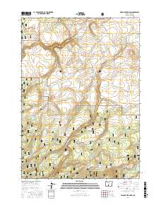
2017 Map of Bridge Creek Draw
USGS Topo · Published 2017About this map
Fremont National Forest dominates this high-elevation landscape in Lake County, where water resources are carefully managed through a series of springs, waterholes, and reservoirs. The drainage patterns of Bridge Creek Draw and Timothy Cr are central to the terrain, feeding into basins like Ted Reservoir and South Spring Reservoir. This map illustrates the vital infrastructure for livestock and land management in the Oregon high country, featuring numerous named water sources including McBroom Spring, Lundy Spring, and Cliff Spring. The southern portion of the map transitions into the more riparian environment of the Silver Creek Marsh, where the W Fork Silver Creek meanders through the flats. This area is also traversed by the Southern Oregon Intertie Trail, a notable north-south utility and travel corridor that cuts through the forested and open sections of the quadrangle.
Find a feature on this map
39 named features on this map. Tap any name to fly to it.
Don’t see what you’re looking for? This feature index may not catch every label — zoom into the map to look around manually.
Map Details
Editions of this 2017 Bridge Creek Draw Map
This is the sole edition of this map. No revisions or reprints were ever made.
Other maps of this area

1889 · Klamath
USGS Topo · 1:250,000

1894 · Klamath
USGS Topo · 1:250,000

1955 · Crescent
USGS Topo · 1:250,000

1955 · Klamath Falls
USGS Topo · 1:250,000

1957 · Crescent
USGS Topo · 1:250,000

1958 · Crescent
USGS Topo · 1:250,000

1958 · Klamath Falls
USGS Topo · 1:250,000

1960 · Sycan Marsh
USGS Topo · 1:62,500

1960 · Yamsay Mountain
USGS Topo · 1:62,500

1968 · Silver Lake
USGS Topo · 1:24,000