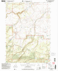
2004 Map of Bridge Creek Draw
USGS Topo · Published 2007About this map
Fremont National Forest and the Fort Rock Wildlife Area dominate this high-desert landscape in Lake County, where land use revolves around widely spaced ranching operations and natural water sources. The map records several established family holdings, including Howard Ranch, Freeman Ranch, and McBroom Ranch, which are situated near critical drainage points like Timothy Creek and Bridge Creek. The distribution of these ranches illustrates how settlement patterns followed the limited water supply in an otherwise arid environment.
Find a feature on this map
35 named features on this map. Tap any name to fly to it.
Don’t see what you’re looking for? This feature index may not catch every label — zoom into the map to look around manually.
Map Details
Editions of this 2004 Bridge Creek Draw Map
This is the sole edition of this map. No revisions or reprints were ever made.
Other maps of this area

1889 · Klamath
USGS Topo · 1:250,000

1894 · Klamath
USGS Topo · 1:250,000

1955 · Crescent
USGS Topo · 1:250,000

1955 · Klamath Falls
USGS Topo · 1:250,000

1957 · Crescent
USGS Topo · 1:250,000

1958 · Crescent
USGS Topo · 1:250,000

1958 · Klamath Falls
USGS Topo · 1:250,000

1960 · Sycan Marsh
USGS Topo · 1:62,500

1960 · Yamsay Mountain
USGS Topo · 1:62,500

1968 · Silver Lake
USGS Topo · 1:24,000