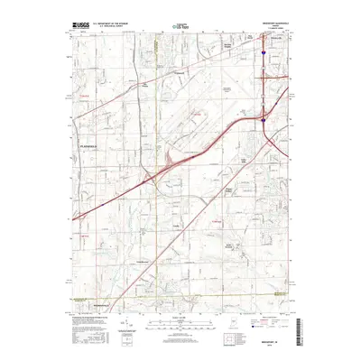
2016 Map of Bridgeport
USGS Topo · Published 2016About this map
Indianapolis International Airport dominates the central landscape of this western Marion County survey, illustrating the significant infrastructure footprint required by modern aviation. Surrounding the airfield, a series of established communities such as Bridgeport, Ben Davis, and Mickleyville transition from dense suburban grids into the more dispersed settlement patterns of Plainfield and West Newton. The area's Quaker heritage is visible through several burial grounds, including the Bridgeport Friends Cem and Fairfield Friends Cem located near Friendswood.
Find a feature on this map
111 named features on this map. Tap any name to fly to it.
Don’t see what you’re looking for? This feature index may not catch every label — zoom into the map to look around manually.
Map Details
Editions of this 2016 Bridgeport Map
This is the sole edition of this map. No revisions or reprints were ever made.
Other maps of this area

1948 · Maywood
USGS Topo · 1:24,000

1948 · Indianapolis West
USGS Topo · 1:24,000

1952 · Bargersville
USGS Topo · 1:24,000

1953 · Bridgeport
USGS Topo · 1:24,000

1953 · Brownsburg
USGS Topo · 1:24,000

1953 · Plainfield
USGS Topo · 1:24,000

1953 · Clermont
USGS Topo · 1:24,000

1953 · Indianapolis
USGS Topo · 1:250,000

1955 · Mooresville West
USGS Topo · 1:24,000

1955 · Mooresville East
USGS Topo · 1:24,000