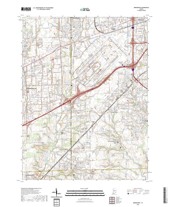
2022 Map of Bridgeport
USGS Topo · Published 2022About this map
Indianapolis International Airport dominates the center of this 2022 survey, reflecting the modern industrial and transportation landscape on the outskirts of the state capital. The surrounding area preserves a network of older settlements and crossroads such as Bridgeport, Six Points, and Valley Mills, even as suburban expansion and major thoroughfares like Kentucky Ave and W Morris St reshape the terrain. Genealogists will find several burial sites maintained amidst the development, including the Bethel Cem Indianapolis Airport and Bridgeport Cem. To the south and west, the landscape transitions to more open ground near Friendswood and Mooresville, where East Fork White Lick Creek and its tributaries like Black Cr drain the land. Outdoor recreation is represented by the Sodalis Nature Park Trl and the Vandalia Rail-Trl, which follows a former rail corridor.
Find a feature on this map
83 named features on this map. Tap any name to fly to it.
Don’t see what you’re looking for? This feature index may not catch every label — zoom into the map to look around manually.
Map Details
Editions of this 2022 Bridgeport Map
This is the sole edition of this map. No revisions or reprints were ever made.
Other maps of this area

1948 · Maywood
USGS Topo · 1:24,000

1948 · Indianapolis West
USGS Topo · 1:24,000

1952 · Bargersville
USGS Topo · 1:24,000

1953 · Bridgeport
USGS Topo · 1:24,000

1953 · Brownsburg
USGS Topo · 1:24,000

1953 · Plainfield
USGS Topo · 1:24,000

1953 · Clermont
USGS Topo · 1:24,000

1953 · Indianapolis
USGS Topo · 1:250,000

1955 · Mooresville West
USGS Topo · 1:24,000

1955 · Mooresville East
USGS Topo · 1:24,000