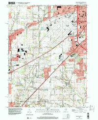
1998 Map of Bridgeport
USGS Topo · Published 2000About this map
Indianapolis International Airport and its surrounding suburbs dominate this late-twentieth-century landscape where Marion, Hendricks, and Morgan counties meet. The map documents the heavy expansion of infrastructure around Indianapolis. during this era, evidenced by the sprawling rail lines of Conrail and major interchanges like Interchange 9 & 73. Despite this industrial growth, the map preserves older community centers such as West Newton and Valley Mills, alongside educational landmarks like Decatur Central High Sch.
Find a feature on this map
75 named features on this map. Tap any name to fly to it.
Don’t see what you’re looking for? This feature index may not catch every label — zoom into the map to look around manually.
Map Details
Editions of this 1998 Bridgeport Map
This is the sole edition of this map. No revisions or reprints were ever made.
Other maps of this area

1948 · Maywood
USGS Topo · 1:24,000

1948 · Indianapolis West
USGS Topo · 1:24,000

1952 · Bargersville
USGS Topo · 1:24,000

1953 · Bridgeport
USGS Topo · 1:24,000

1953 · Brownsburg
USGS Topo · 1:24,000

1953 · Plainfield
USGS Topo · 1:24,000

1953 · Clermont
USGS Topo · 1:24,000

1953 · Indianapolis
USGS Topo · 1:250,000

1955 · Mooresville West
USGS Topo · 1:24,000

1955 · Mooresville East
USGS Topo · 1:24,000