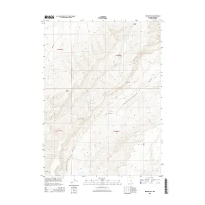
2015 Map of Bridger Pass
USGS Topo · Published 2015About this map
Bridger Pass stands as a significant waypoint along the high-elevation geography of the Continental Divide in Carbon County. This 2015 survey documents a rugged corridor where the Continental Divide National Scenic Trail winds through the landscape, flanked by the prominent Atlantic Rim to the east. The terrain is characterized by deep drainages like Squaw Canyon and Jep Canyon, which channel seasonal water into larger systems such as Separation Creek. Remote access is provided by unpaved routes like Twentymile Rd and Bridger Pass Rd, tracing the same paths used by travelers for generations through this high-desert environment. Geographic landmarks like Miller Hill and Hay Gulch emphasize the complex topography of the region, providing a modern look at the hydrologic and topographic patterns of the Wyoming interior.
Find a feature on this map
22 named features on this map. Tap any name to fly to it.
Don’t see what you’re looking for? This feature index may not catch every label — zoom into the map to look around manually.
Map Details
Editions of this 2015 Bridger Pass Map
This is the sole edition of this map. No revisions or reprints were ever made.
Other maps of this area

1932 · Savery
USGS Topo · 1:96,000

1940 · Savery
USGS Topo · 1:125,000

1954 · Rawlins
USGS Topo · 1:250,000

1956 · Bridger Pass
USGS Topo · 1:62,500

1957 · Doty Mountain
USGS Topo · 1:62,500

1958 · Rawlins
USGS Topo · 1:250,000

1961 · Pine Grove Ranch
USGS Topo · 1:24,000

1961 · Pole Gulch
USGS Topo · 1:24,000

1962 · Rawlins
USGS Topo · 1:250,000

1966 · Riner
USGS Topo · 1:24,000