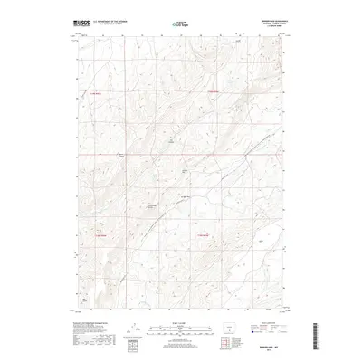
2017 Map of Bridger Pass
USGS Topo · Published 2017About this map
Bridger Pass stands as the central historical landmark on this high-altitude Wyoming survey, marking a vital crossing point on the Continental Divide. The landscape is defined by the massive uplift of the Atlantic Rim and Miller Hill, with dramatic topography carved by Scotty Canyon and Jep Canyon. This rugged terrain serves as a significant drainage divide for the region's complex water system, where headwaters like Separation Cr and Eagle Cr flow from the slopes. The map traces the modern path of the Continental Divide National Scenic Trail- Wyoming Portion, which follows the high ridges once traversed by early western expeditions. Grounded in the 2017 Bureau of Land Management data, the sheet documents the remote road network including Bridger Pass Rd and Twenty Mile Rd, providing essential context for the contemporary management of this vast open range.
Find a feature on this map
22 named features on this map. Tap any name to fly to it.
Don’t see what you’re looking for? This feature index may not catch every label — zoom into the map to look around manually.
Map Details
Editions of this 2017 Bridger Pass Map
This is the sole edition of this map. No revisions or reprints were ever made.
Other maps of this area

1932 · Savery
USGS Topo · 1:96,000

1940 · Savery
USGS Topo · 1:125,000

1954 · Rawlins
USGS Topo · 1:250,000

1956 · Bridger Pass
USGS Topo · 1:62,500

1957 · Doty Mountain
USGS Topo · 1:62,500

1958 · Rawlins
USGS Topo · 1:250,000

1961 · Pine Grove Ranch
USGS Topo · 1:24,000

1961 · Pole Gulch
USGS Topo · 1:24,000

1962 · Rawlins
USGS Topo · 1:250,000

1966 · Riner
USGS Topo · 1:24,000