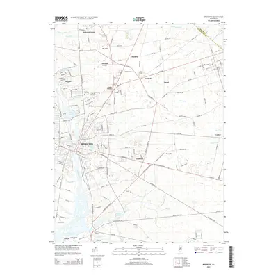
2014 Map of Bridgeton
USGS Topo · Published 2014About this map
The Cohansey River winds through the heart of Bridgeton, anchoring a landscape where agricultural heritage meets suburban development. This 2014 survey reveals a dense network of water features, from the recreational waters of Mary Elmer Lake and Sunset Lake to the marshy reaches of Rattlesnake Gut and Jackson Run. The transition from the urban center to the surrounding farmland is marked by historic agricultural centers like Seabrook Farms and Orchard Center, alongside smaller settlements such as Carlls Corner and Gouldtown. Genealogists and local historians will find significant landmarks preserved on this sheet, including the Old Presbyterian Cem near Fairton and the Laurel Lawn Cem. The transportation infrastructure is well-defined, showing the convergence of routes at Bridgeton Junction and the presence of specialized facilities like Bucks Airport, illustrating how the region's economy remains tied to its geography and transit corridors.
Find a feature on this map
172 named features on this map. Tap any name to fly to it.
Don’t see what you’re looking for? This feature index may not catch every label — zoom into the map to look around manually.
Map Details
Editions of this 2014 Bridgeton Map
This is the sole edition of this map. No revisions or reprints were ever made.
Other maps of this area

1890 · Salem
USGS Topo · 1:62,500

1890 · Bay Side
USGS Topo · 1:62,500

1890 · Bridgeton
USGS Topo · 1:62,500

1890 · Glassboro
USGS Topo · 1:62,500

1894 · Bay Side
USGS Topo · 1:62,500

1894 · Bridgeton
USGS Topo · 1:62,500

1898 · Salem
USGS Topo · 1:62,500

1898 · Glassboro
USGS Topo · 1:62,500

1899 · Vineland
USGS Topo · 1:125,000

1901 · Camden
USGS Topo · 1:125,000