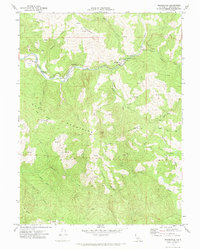
1969 Map of Bridgeville
USGS Topo · Published 1974About this map
Bridgeville serves as the primary settlement hub along the Van Duzen River, where the canyon landscape meets vital infrastructure like the Fire Control Station and a local Substation. This 1969 survey captures a remote Humboldt County terrain defined by significant elevation changes, from the heights of the Chalk Mountains and Mt Baldy down to river-bottom flats like Petty Flat and Swains Flat.
Find a feature on this map
35 named features on this map. Tap any name to fly to it.
Don’t see what you’re looking for? This feature index may not catch every label — zoom into the map to look around manually.
Map Details
Editions of this 1969 Bridgeville Map
2 editions found
Other maps of this area

1914 · Pilot Creek
USGS Topo · 1:62,500

1915 · Big Bar and Vicinity
USGS Topo · 1:250,000

1921 · Dyerville
USGS Topo · 1:62,500

1922 · Kneeland
USGS Topo · 1:62,500

1949 · Blocksburg
USGS Topo · 1:62,500

1949 · Weott
USGS Topo · 1:62,500

1950 · Iaqua Buttes
USGS Topo · 1:62,500

1951 · Weott
USGS Topo · 1:62,500

1951 · Blocksburg
USGS Topo · 1:62,500

1951 · Pilot Creek
USGS Topo · 1:62,500