
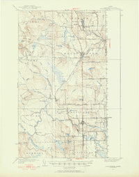
1951 Map of Bridgewater
USGS Topo · Published 1952About this map
Monticello and Bridgewater sit as key points of transit along the international border in this mid-century portrait of Aroostook County. The Bangor and Aroostook railroad bisects the landscape, providing a vital link for the region's agricultural economy, with Monticello Sta serving as a focal point. Settlement patterns follow the river valleys and primary roads, evidenced by clusters at Robinsons and Jewells Corner.
Find a feature on this map
78 named features on this map. Tap any name to fly to it.
Don’t see what you’re looking for? This feature index may not catch every label — zoom into the map to look around manually.
Map Details
Editions of this 1951 Bridgewater Map
3 editions found
Other maps of this area

1934 · Bridgewater
USGS Topo · 1:48,000

1935 · Howe Brook
USGS Topo · 1:48,000

1935 · Presque Isle
USGS Topo · 1:62,500

1936 · Mars Hill
USGS Topo · 1:48,000

1937 · Smyrna Mills
USGS Topo · 1:62,500

1938 · Bridgewater
USGS Topo · 1:62,500

1938 · Houlton
USGS Topo · 1:62,500

1939 · Howe Brook
USGS Topo · 1:62,500

1940 · Mars Hill
USGS Topo · 1:62,500

1951 · Mars Hill
USGS Topo · 1:62,500