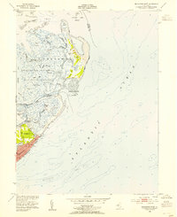
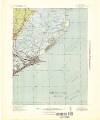
1952 Map of Brigantine Inlet
USGS Topo · Published 1954About this map
The coastal wetlands and barrier islands of Galloway are meticulously documented in the early 1950s, a period before intensive modern development reshaped the New Jersey shore. The Brigantine National Wildlife Refuge dominates the northern marshlands, an intricate web of tidal channels including Mile Thorofare, Great Thorofare, and Cabbage Thorofare. To the south, the growing settlement of Brigantine is visible, centered around Brigantine Ave and the 14th Street Pier.
Find a feature on this map
43 named features on this map. Tap any name to fly to it.
Don’t see what you’re looking for? This feature index may not catch every label — zoom into the map to look around manually.
Map Details
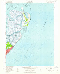
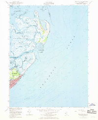
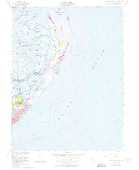
Editions of this 1952 Brigantine Inlet Map
4 editions found
Other maps of this area

1887 · Atlantic City
USGS Topo · 1:62,500

1888 · Little Egg Harbor
USGS Topo · 1:62,500

1888 · Long Beach
USGS Topo · 1:62,500

1893 · Little Egg Harbor
USGS Topo · 1:62,500

1893 · Long Beach
USGS Topo · 1:62,500

1894 · Atlantic City
USGS Topo · 1:62,500

1919 · Long Beach
USGS Topo · 1:62,500

1920 · Little Egg Harbor
USGS Topo · 1:62,500

1940 · Atlantic City
USGS Topo · 1:62,500
1941 · Atlantic City
USGS Topo · 1:62,500
Featured Places
- Galloway Township, NJ
- Little Egg Harbor Township, NJ
- Brigantine, NJ
- Ocean County, NJ
- Atlantic County, NJ