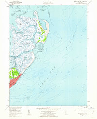
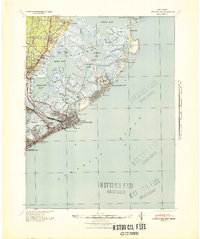
1952 Map of Brigantine Inlet
USGS Topo · Published 1962About this map
Brigantine National Wildlife Refuge dominates this coastal landscape, protecting a complex network of salt marshes and tidal channels. The intricate hydrology of the area is mapped with precision, showing the shifting sandbars of Little Egg Inlet and the deep cuts of the Intracoastal Waterway and Brigantine Channel. To the south, the city of Brigantine begins its grid-like expansion, centered around landmarks like the 14th Street Pier and the adjacent Baremore Quarters.
Find a feature on this map
44 named features on this map. Tap any name to fly to it.
Don’t see what you’re looking for? This feature index may not catch every label — zoom into the map to look around manually.
Map Details
Editions of this 1952 Brigantine Inlet Map
4 editions found
Other maps of this area

1887 · Atlantic City
USGS Topo · 1:62,500

1888 · Little Egg Harbor
USGS Topo · 1:62,500

1888 · Long Beach
USGS Topo · 1:62,500

1893 · Little Egg Harbor
USGS Topo · 1:62,500

1893 · Long Beach
USGS Topo · 1:62,500

1894 · Atlantic City
USGS Topo · 1:62,500

1919 · Long Beach
USGS Topo · 1:62,500

1920 · Little Egg Harbor
USGS Topo · 1:62,500

1940 · Atlantic City
USGS Topo · 1:62,500
1941 · Atlantic City
USGS Topo · 1:62,500
Featured Places
- Galloway Township, NJ
- Little Egg Harbor Township, NJ
- Brigantine, NJ
- Ocean County, NJ
- Atlantic County, NJ