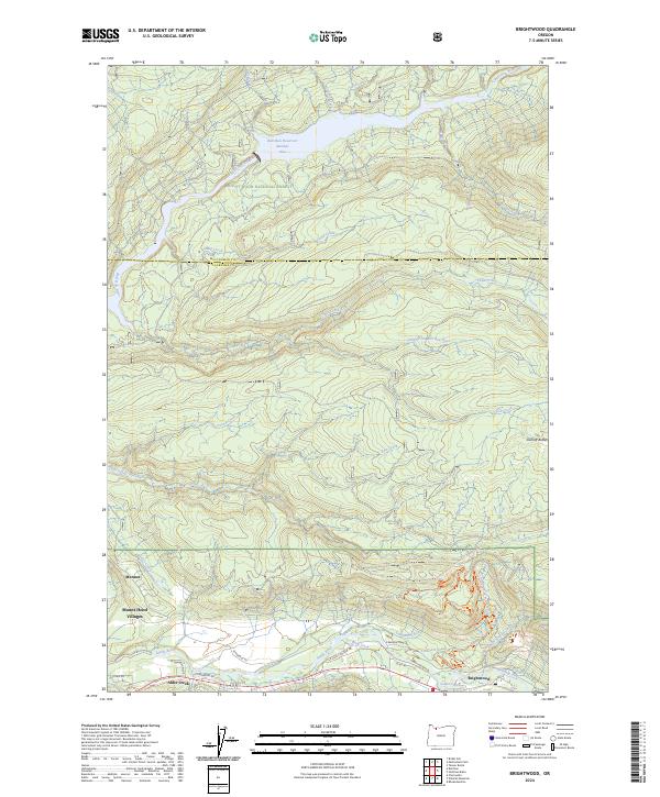
2024 Map of Brightwood
USGS Topo · Published 2024About this map
Mount Hood National Forest encompasses much of this terrain, where the northern corridor is dominated by the protected waters of Bull Run Reservoir Number One. The landscape is defined by the convergence of significant water systems, including the Sandy River, the Salmon River, and the Bull Run River. Settlement is concentrated along the southern valley floor, where the communities of Brightwood, Alder Creek, and Marmot are situated. The presence of E Barlow Trail Rd provides a link to the overland emigrant history of the region, while modern recreational development is evident in the extensive trail networks such as the Sandy Ridge Hide And Seek Trl and Sandy Ridge Communication Breakdown Trl. This area serves as a critical transition between the high forest and the residential developments of Mount Hood Villages.
Find a feature on this map
40 named features on this map. Tap any name to fly to it.
Don’t see what you’re looking for? This feature index may not catch every label — zoom into the map to look around manually.
Map Details
Editions of this 2024 Brightwood Map
This is the sole edition of this map. No revisions or reprints were ever made.
Other maps of this area

1916 · Estacada
USGS Topo · 1:125,000

1924 · Mount Hood
USGS Topo · 1:125,000

1926 · Hood River
USGS Topo · 1:125,000

1927 · Mount Hood
USGS Topo · 1:125,000

1929 · Hood River
USGS Topo · 1:125,000

1948 · Vancouver
USGS Topo · 1:250,000

1950 · Vancouver
USGS Topo · 1:250,000

1950 · Vancouver
USGS Topo · 1:250,000

1953 · The Dalles
USGS Topo · 1:250,000

1954 · Bridal Veil
USGS Topo · 1:62,500