
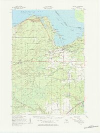
1951 Map of Brimley
USGS Topo · Published 1958About this map
Point Iroquois stands as a prominent sentinel on the shoreline of Whitefish Bay, marking the transition from the lake into the Saint Marys River. This mid-century survey illustrates the rural and tribal landscapes of Chippewa County, including the Bay Mills Indian Reservation and the shoreline community of Bay Mills. The map provides significant detail for local historians, documenting scattered settlements like Dollar Settlement and Dorgans Crossing along the rail lines.
Find a feature on this map
80 named features on this map. Tap any name to fly to it.
Don’t see what you’re looking for? This feature index may not catch every label — zoom into the map to look around manually.
Map Details
Editions of this 1951 Brimley Map
2 editions found
Other maps of this area

1913 · Sault Sainte Marie
USGS Topo · 1:62,500

1941 · Sault Sainte Marie
USGS Topo · 1:63,360

1941 · Strongs
USGS Topo · 1:63,360

1941 · Brimley
USGS Topo · 1:63,360

1951 · Shallows
USGS Topo · 1:24,000

1951 · Pendills Lake
USGS Topo · 1:24,000

1951 · Dollar Settlement
USGS Topo · 1:24,000

1951 · Sullivan Creek
USGS Topo · 1:24,000

1951 · Raco
USGS Topo · 1:24,000

1951 · Kinross
USGS Topo · 1:24,000