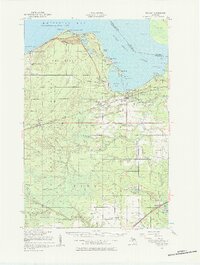
1951 Map of Brimley
USGS Topo · Published 1984About this map
Whitefish Bay and the Saint Marys River define the northern and eastern reaches of this Upper Peninsula landscape, where the international boundary meets the waters of Back Bay and Waiska Bay. The map captures a transition from shoreline settlements like Dollar Settlement and Brimley to the heavily forested interior dominated by the Munuscong State Forest. Evidence of early community life is preserved in the locations of the Indian Mission Ch, St Catherines Ch, and several rural schools including the Dollar Settlement Sch and Holland Sch. The transport network of the era is anchored by two major rail lines: the Duluth South Shore and Atlantic and the Minneapolis St Paul and Sault Ste Marie Railroad, which served inland hubs such as Dafter and Kinross. Historical insights include the presence of numerous family-named landmarks like McMahen Creek and Garlinghouse Lake, alongside the strategic Point Iroquois lighthouse site.
Find a feature on this map
81 named features on this map. Tap any name to fly to it.
Don’t see what you’re looking for? This feature index may not catch every label — zoom into the map to look around manually.
Map Details
Editions of this 1951 Brimley Map
2 editions found

Other maps of this area

1913 · Sault Sainte Marie
USGS Topo · 1:62,500

1941 · Sault Sainte Marie
USGS Topo · 1:63,360

1941 · Strongs
USGS Topo · 1:63,360

1941 · Brimley
USGS Topo · 1:63,360

1951 · Shallows
USGS Topo · 1:24,000

1951 · Pendills Lake
USGS Topo · 1:24,000

1951 · Dollar Settlement
USGS Topo · 1:24,000

1951 · Sullivan Creek
USGS Topo · 1:24,000

1951 · Raco
USGS Topo · 1:24,000

1951 · Kinross
USGS Topo · 1:24,000