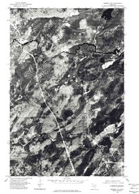
1976 Map of Brimson NW
USGS Topo · Published 1979About this map
Skibo stands as the primary structural point of interest on this 1976 orthophotoquad, situated in the northwestern reaches of the Brimson area. This aerial perspective captures the winding path of the St Louis River as it snakes through the dense woodland and wetland terrain of northeastern Minnesota. The photograph, taken in May, reveals the complex hydrologic network of the region, where the dark, meandering river contrasts sharply against the variegated vegetation and marshy depressions. In the lower corner, the expanse of Bassett Lake is visible, providing a clear reference point for the low-lying glacial topography. This specific type of imagery is invaluable for researchers tracing the physical evolution of the Iron Range backcountry, showing the intersection of early rail corridors with the natural drainage patterns of the St. Louis River valley before decades of further forest succession and development changed the landscape.
Find a feature on this map
3 named features on this map. Tap any name to fly to it.
Don’t see what you’re looking for? This feature index may not catch every label — zoom into the map to look around manually.
Map Details
Editions of this 1976 Brimson NW Map
This is the sole edition of this map. No revisions or reprints were ever made.
Other maps of this area

1949 · Allen
USGS Topo · 1:24,000

1950 · Allen
USGS Topo · 1:24,000

1951 · Babbitt SW
USGS Topo · 1:24,000

1952 · Babbitt SE
USGS Topo · 1:24,000

1954 · Two Harbors
USGS Topo · 1:250,000

1954 · Hibbing
USGS Topo · 1:250,000

1957 · Two Harbors
USGS Topo · 1:250,000

1957 · Hibbing
USGS Topo · 1:250,000

1957 · Brimson
USGS Topo · 1:62,500

1957 · Markham
USGS Topo · 1:62,500