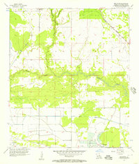
1956 Map of Brimstone
USGS Topo · Published 1957About this map
Edgerly Oil Field and the Sulphur Oil Field dominate the low-lying terrain of western Calcasieu Parish in this mid-1950s survey. The landscape is defined by the heavy infrastructure of the petroleum industry, including a designated Landing Field and a prominent Radio Tower near the small settlement of Brimstone. The hydrology of the region is equally central, with the Houston River winding through the center of the sheet, supported by the industrial-scale Houston River Canal and northern tributaries like Cowards Gully and Buxton Creek. Transportation is anchored by the Kansas City Southern railroad, which cuts through the northeastern corner. In the northern reaches, the De Quincy Lookout Tower stands as a sentinel over the mix of marshland and development, reflecting an era where resource extraction and water management reshaped the coastal Louisiana prairie.
Find a feature on this map
12 named features on this map. Tap any name to fly to it.
Don’t see what you’re looking for? This feature index may not catch every label — zoom into the map to look around manually.
Map Details
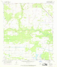
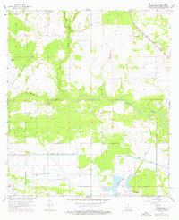
Editions of this 1956 Brimstone Map
3 editions found
Other maps of this area

1932 · Orange
USGS Topo · 1:62,500

1935 · Buhler
USGS Topo · 1:31,680

1935 · Gordon
USGS Topo · 1:31,680

1947 · Sulphur
USGS Topo · 1:31,680

1947 · Vinton
USGS Topo · 1:31,680

1947 · DeQuincy
USGS Topo · 1:31,680

1947 · Sulphur Mines
USGS Topo · 1:31,680
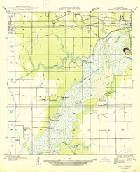
1947 · West Lake
USGS Topo · 1:31,680

1947 · Lunita
USGS Topo · 1:31,680

1947 · Long Marsh
USGS Topo · 1:31,680