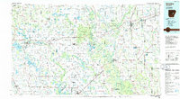
1986 Map of Brinkley
USGS Topo · Published 1986About this map
The Grand Prairie region of eastern Arkansas is documented here during the mid-1980s, revealing a landscape deeply defined by its hydrology and transportation corridors. The White River and Cache River carve winding paths through the eastern half of the map, buffered by the Wattensaw State Wildlife Management Area and Dagmar State Wildlife Management Area. These bottomlands contrast sharply with the geometric precision of the surrounding agricultural lands and the linear progress of Interstate 40.
Find a feature on this map
204 named features on this map. Tap any name to fly to it.
Don’t see what you’re looking for? This feature index may not catch every label — zoom into the map to look around manually.
Map Details
Editions of this 1986 Brinkley Map
This is the sole edition of this map. No revisions or reprints were ever made.
Other maps of this area

1891 · Little Rock
USGS Topo · 1:125,000

1893 · Little Rock
USGS Topo · 1:125,000

1932 · Kensett
USGS Topo · 1:62,500

1932 · Pastoria
USGS Topo · 1:62,500

1935 · Kensett
USGS Topo · 1:62,500

1935 · Altheimer
USGS Topo · 1:62,500

1935 · Hazen
USGS Topo · 1:62,500

1935 · Pastoria
USGS Topo · 1:62,500

1935 · Clarendon
USGS Topo · 1:62,500

1935 · Gregory
USGS Topo · 1:62,500