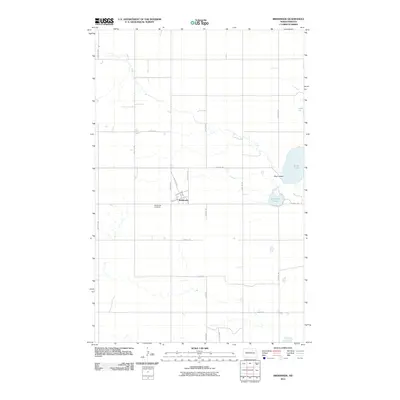
2011 Map of Brinsmade
USGS Topo · Published 2011About this map
Brinsmade stands as the central settlement in this Benson County landscape, where a grid of local roads like Railroad Ave and Benson Ave N defines the small-town layout. The surrounding prairie is marked by a series of significant water bodies, most notably Silver Lake and Lake Yri to the east. The drainage of Big Coulee connects these eastern waters, flowing toward O'Connell Lake. This 2011 survey documents the intersection of rural agriculture and geography, providing a clear record of local infrastructure from 58th Ave NE to 63rd Ave NE. For those researching local family history, the Brinsmade Cemetery remains a primary landmark just west of the town center, serving as a vital point for genealogical study in this part of North Dakota.
Find a feature on this map
22 named features on this map. Tap any name to fly to it.
Don’t see what you’re looking for? This feature index may not catch every label — zoom into the map to look around manually.
Map Details
Editions of this 2011 Brinsmade Map
This is the sole edition of this map. No revisions or reprints were ever made.
Other maps of this area

1932 · Grahams Island
USGS Topo · 1:62,500

1950 · Grahams Island
USGS Topo · 1:62,500

1951 · Tilden
USGS Topo · 1:24,000

1951 · Minnewaukan East
USGS Topo · 1:24,000

1953 · Devils Lake
USGS Topo · 1:250,000

1956 · Devils Lake
USGS Topo · 1:250,000

1956 · Brinsmade
USGS Topo · 1:24,000

1957 · Comstock
USGS Topo · 1:24,000

1957 · Churchs Ferry
USGS Topo · 1:24,000
1957 · Brinsmade
USGS Topo · 1:24,000