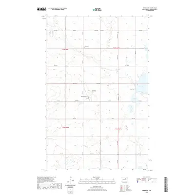
2020 Map of Brinsmade
USGS Topo · Published 2020About this map
Brinsmade serves as the central hub of this Benson County landscape, where the intersection of Benson Ave and Railroad Ave reflects the village's historic development alongside the local transit corridor. The area is defined by its numerous glacial water bodies, including Lake Yri, Silver Lake, and O'Connell Lake, which are linked by the winding drainage of Big Coulee. This water-rich prairie environment is marked by several early community landmarks that offer significant value for genealogical research. Three distinct burial grounds—Lebanon Cem, Saint John's Catholic Cem, and the Brinsmade Lutheran Cem—point to the diverse denominational heritage of the township's early settlers. The grid of county roads, such as Co Rd 0314 and 57th St NE, connects these landmarks across the northern Great Plains terrain.
Find a feature on this map
23 named features on this map. Tap any name to fly to it.
Don’t see what you’re looking for? This feature index may not catch every label — zoom into the map to look around manually.
Map Details
Editions of this 2020 Brinsmade Map
This is the sole edition of this map. No revisions or reprints were ever made.
Other maps of this area

1932 · Grahams Island
USGS Topo · 1:62,500

1950 · Grahams Island
USGS Topo · 1:62,500

1951 · Tilden
USGS Topo · 1:24,000

1951 · Minnewaukan East
USGS Topo · 1:24,000

1953 · Devils Lake
USGS Topo · 1:250,000

1956 · Devils Lake
USGS Topo · 1:250,000

1956 · Brinsmade
USGS Topo · 1:24,000

1957 · Comstock
USGS Topo · 1:24,000

1957 · Churchs Ferry
USGS Topo · 1:24,000
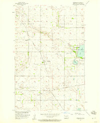
1957 · Brinsmade
USGS Topo · 1:24,000