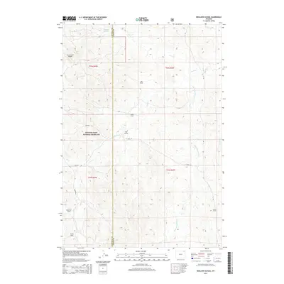
2015 Map of Brislawn School
USGS Topo · Published 2015About this map
Thunder Basin National Grassland dominates the western portion of this landscape, where the high plains of Northeast Wyoming meet the drainages of the Powder River Basin. The terrain is defined by a network of ephemeral watercourses and eroded depressions, including Big Draw, Heald Draw, and Dry Hollow. To the northwest, the Duck Creek Breaks indicate more significant topographic relief. In the southeast corner, the namesake Brislawn School sits as a quiet institutional landmark along the drainage of Short Prong Prairie Cr. Settlement and travel are sparse, concentrated along rural corridors such as Deadman Rd and La Ranch Rd. This area reflects the modern cattle-ranching and conservation character of the Campbell and Crook County border, where water features like Edgerton Reservoir provide essential resources in a semi-arid environment.
Find a feature on this map
25 named features on this map. Tap any name to fly to it.
Don’t see what you’re looking for? This feature index may not catch every label — zoom into the map to look around manually.
Map Details
Editions of this 2015 Brislawn School Map
This is the sole edition of this map. No revisions or reprints were ever made.
Other maps of this area

1905 · Devils Tower
USGS Topo · 1:125,000

1954 · Gillette
USGS Topo · 1:250,000

1955 · Gillette
USGS Topo · 1:250,000

1957 · Oshoto
USGS Topo · 1:62,500

1957 · Cedar Ridge
USGS Topo · 1:62,500

1958 · Gillette
USGS Topo · 1:250,000

1962 · Gillette
USGS Topo · 1:250,000
1972 · Bonnie Reservoir
USGS Topo · 1:24,000
1972 · Bowman Hill
USGS Topo · 1:24,000
1972 · Brislawn School
USGS Topo · 1:24,000