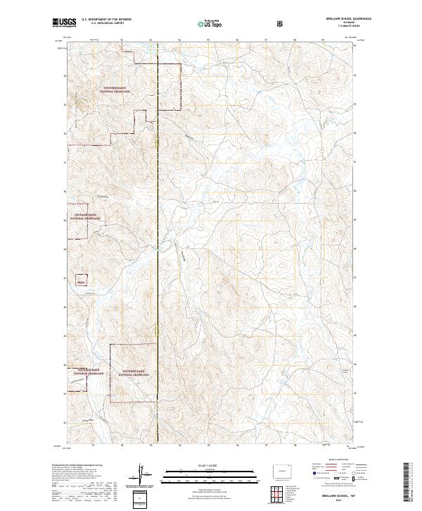
2021 Map of Brislawn School
USGS Topo · Published 2021About this map
Brislawn School sits on the eastern edge of a high-plains landscape defined by its complex drainage network and vast public rangelands. The terrain is deeply incised by named erosional features such as Duck Creek Breaks, Big Draw, and Dry Hollow, which reveal the rugged topography of the Powder River Basin. Much of the western and central portions of the map fall within the Thunder Basin National Grassland, a testament to the large-scale land utilization projects in the region. Water remains a critical focus of the landscape, marked by the Edgerton Reservoir and numerous seasonal watercourses like Horse Cr and Short Prong Prairie Cr. The sparse road network, including Deadman Rd and Co Rd 68, follows the natural contours of the land, connecting isolated ranching interests across the Campbell and Crook County line.
Find a feature on this map
25 named features on this map. Tap any name to fly to it.
Don’t see what you’re looking for? This feature index may not catch every label — zoom into the map to look around manually.
Map Details
Editions of this 2021 Brislawn School Map
This is the sole edition of this map. No revisions or reprints were ever made.
Other maps of this area

1905 · Devils Tower
USGS Topo · 1:125,000

1954 · Gillette
USGS Topo · 1:250,000

1955 · Gillette
USGS Topo · 1:250,000

1957 · Oshoto
USGS Topo · 1:62,500

1957 · Cedar Ridge
USGS Topo · 1:62,500

1958 · Gillette
USGS Topo · 1:250,000

1962 · Gillette
USGS Topo · 1:250,000
1972 · Bonnie Reservoir
USGS Topo · 1:24,000
1972 · Bowman Hill
USGS Topo · 1:24,000
1972 · Brislawn School
USGS Topo · 1:24,000