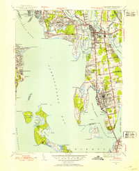
1939 Map of Bristol
USGS Topo · Published 1953About this map
Narragansett Bay and the Providence River define this coastal landscape, surveyed shortly before the mid-century. The peninsula of Bristol is the focal point, showing a dense street grid that transitions into the estates and institutional grounds of the north. Significant local landmarks include the Soldiers Home and several large burial sites such as Juniper Hill Cem and the South Burial Grounds. The maritime character is evident in the numerous coves and points, from Bullock Cove in the north to the southern tip at Bristol Pt.
Find a feature on this map
73 named features on this map. Tap any name to fly to it.
Don’t see what you’re looking for? This feature index may not catch every label — zoom into the map to look around manually.
Map Details
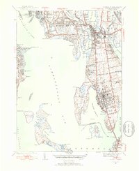
Editions of this 1939 Bristol Map
2 editions found
Other maps of this area

1885 · Taunton
USGS Topo · 1:62,500

1887 · Providence
USGS Topo · 1:62,500

1888 · Fall River
USGS Topo · 1:62,500

1888 · Taunton
USGS Topo · 1:62,500

1889 · Providence
USGS Topo · 1:62,500

1890 · Narragansett Bay
USGS Topo · 1:62,500

1892 · Narragansett Bay
USGS Topo · 1:62,500

1893 · Taunton
USGS Topo · 1:62,500

1893 · Fall River
USGS Topo · 1:62,500

1894 · Providence
USGS Topo · 1:62,500