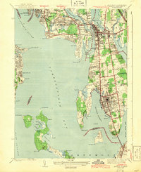
1943 Map of Bristol
USGS Topo · Published 1943About this map
The waters of Narragansett Bay and the Providence River define this coastal survey, showing the complex shoreline of Rhode Island during the early 1940s. The landscape is characterized by prominent peninsulas and necks, including Rumstick Neck and Popasquash Neck, which separate the various coves and harbors. Dense settlement patterns are visible in Bristol and Warren, where a grid of streets meets the waterfront. The New York New Haven and Hartford railroad line provides a vital transportation spine through the coastal communities, connecting the mainland toward East Providence. On the southern edge, the Mount Hope Bridge spans the passage toward Aquidneck Island. Genealogists will find several significant burial sites, such as the South Burial Grounds and Juniper Hill Cem, alongside landmarks like the Soldiers Home and the Rhode Island Country Club.
Find a feature on this map
94 named features on this map. Tap any name to fly to it.
Don’t see what you’re looking for? This feature index may not catch every label — zoom into the map to look around manually.
Map Details
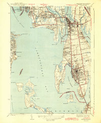
Editions of this 1943 Bristol Map
2 editions found
Other maps of this area

1885 · Taunton
USGS Topo · 1:62,500

1887 · Providence
USGS Topo · 1:62,500

1888 · Fall River
USGS Topo · 1:62,500

1888 · Taunton
USGS Topo · 1:62,500

1889 · Providence
USGS Topo · 1:62,500

1890 · Narragansett Bay
USGS Topo · 1:62,500

1892 · Narragansett Bay
USGS Topo · 1:62,500

1893 · Taunton
USGS Topo · 1:62,500

1893 · Fall River
USGS Topo · 1:62,500

1894 · Providence
USGS Topo · 1:62,500