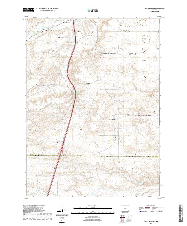
2021 Map of Bristol Ridge NE
USGS Topo · Published 2021About this map
Chugwater sits at the northern edge of this high plains landscape, where the seasonal waters of Chugwater Cr and Dry Cr carve subtle drainage patterns through the expansive Chugwater Flats. The map reveals a transition between the northern reaches of the Laramie Range foothills and the open plateau, defined by a grid of rural ranch roads and the dominant corridor of S Chugwater Hwy. In the southern portion of the quadrangle, the terrain becomes more varied as it approaches the drainage of Bear Cr and N Bear Cr. Local landmarks such as Mud Spring point to the critical role of water sources in this arid environment. The map also documents the administrative boundary between Platte and Laramie Counties, providing a clear look at how property and political lines intersect with the natural topography of southeastern Wyoming.
Find a feature on this map
28 named features on this map. Tap any name to fly to it.
Don’t see what you’re looking for? This feature index may not catch every label — zoom into the map to look around manually.
Map Details
Editions of this 2021 Bristol Ridge NE Map
This is the sole edition of this map. No revisions or reprints were ever made.
Other maps of this area

1953 · Double L Ranch
USGS Topo · 1:24,000

1953 · Chugwater
USGS Topo · 1:24,000

1954 · Cheyenne
USGS Topo · 1:250,000

1958 · Cheyenne
USGS Topo · 1:250,000

1962 · Moffett Ranch
USGS Topo · 1:24,000

1962 · Bristol Ridge
USGS Topo · 1:24,000

1962 · Bristol Ridge NE
USGS Topo · 1:24,000
1962 · Whitcomb Hill
USGS Topo · 1:24,000

1963 · C S Ranch
USGS Topo · 1:24,000

1963 · Klutz Canyon
USGS Topo · 1:24,000